
Cape Reinga, Te Paki giant sand dunes & sunset at 90 mile beach.
In the last days of August 2026 my partner and I set out on a long-expected journey: a 3 week trip through New Zealand. Although our primary motivation were the Lord of the Rings movies which were filmed there, and our trip was closer to a complex treasure hunt than an easygoing holiday, we still wanted to explore everywhere else as well. I charted us a very ambitious course from the northernmost to the southernmost point of the country and I’m happy to say that we managed to do it.
Not many people visit the Far North of New Zealand, i.e. the northernmost parts of the north island, which is understandable, but also severely underrated. The Far North is a district with around 73,000 people in total, which is about 1.4% of the total New Zealand population – in other words, a rather empty stretch of farmland with not a lot of towns to stop in and regular notices for the lack of gas stations along the way. However, if you do decide to visit, it is a beautiful, untamed place and quite rewarding for the long drive. Needless to say, unless you book an organised tour, there’s no public transport and you’d better bring a full tank of gas.
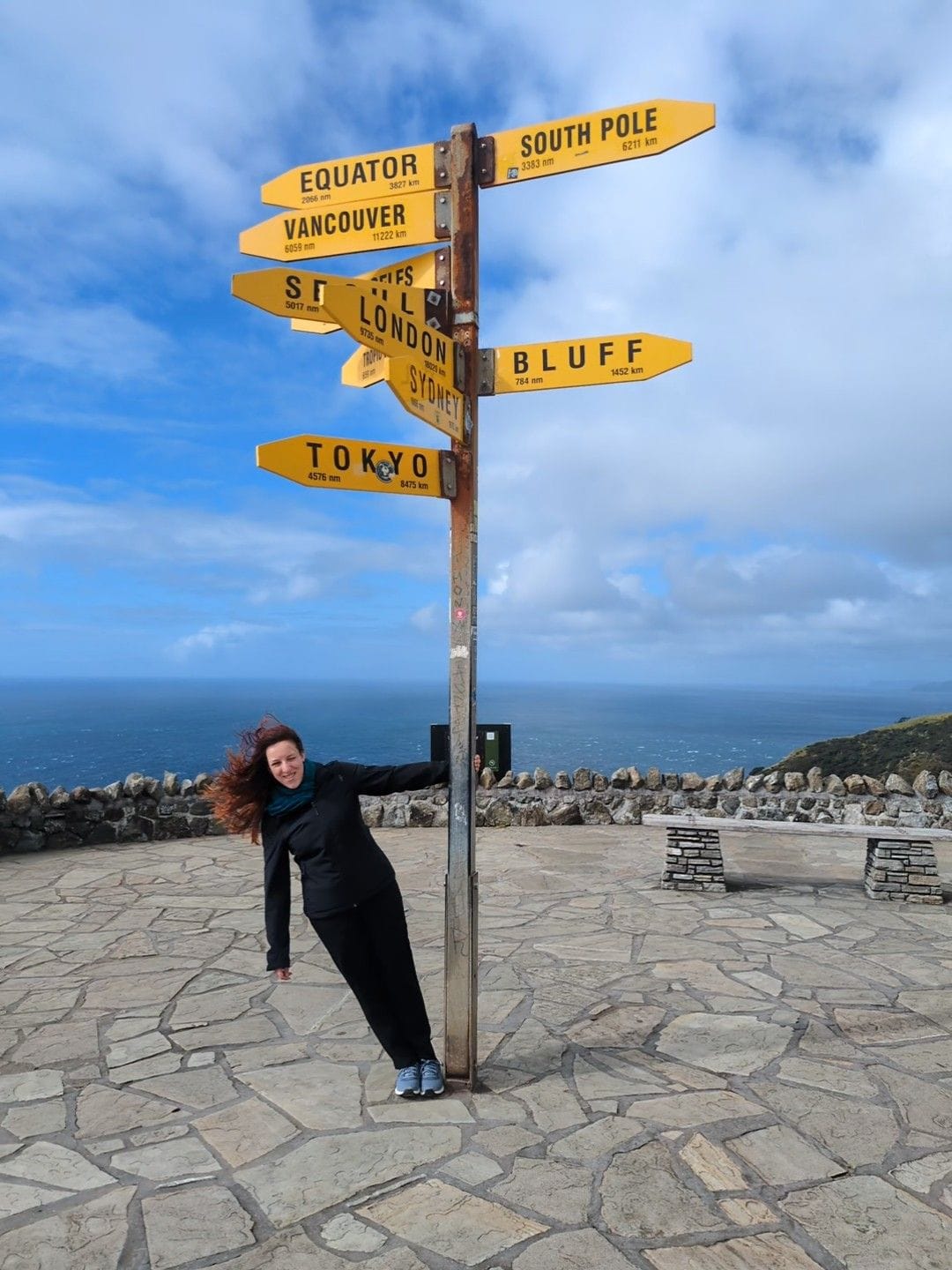
We were based in Paihia, a larger summer resort type of coastal town, and it took us a 3 hour drive one way to reach Cape Reinga, the northernmost point of New Zealand. It can be easily reached via good regional roads and the access road to the cape, which is about 100 km away from the nearest town, has recently been sealed. There’s a lighthouse on the tip of the peninsula with a sign marking the distances in all directions and as you can see in my photos, the place is very, very windy.
In the mythology of the native Maori people, Cape Reinga is where the spirits of the deceased leave Aotearoa (New Zealand) on their way out of this world and the word reinga actually means the underworld. Like many nature sights in New Zealand, it is therefore a sacred place for the Maori and you’ll find information boards explaining the journey of the spirits. They also ask you to respect the departed and refrain from eating and drinking there, which is not much of a sacrifice since any attempts at a picnic would be immediately blown away by the wind.
Despite the fierce wind, there is a lone, severely bent pohutukawa tree sticking out of one of the rock formations on the eastern beach. If you look closely, you can see it on one of my photos below. Named Te Aroha, it is believed to have survived there against all odds for several hundred years, but unlike its fellow trees, which are known as the New Zealand Christmas trees for their large red flowers around Christmas time, this one never flowers. Besides the tree, Cape Reinga hides another secret: it is the meeting place of the Tasman sea from the west and the Pacific ocean from the east and the resulting waves and churns below are pretty epic and the blue of the waters is unreal.
P.S.: Technically, the Surville Cliffs are 3 km further north than Cape Reinga and therefore the real northernmost point on the mainland, but public access is restricted and you would need to obtain a permit from the landowner.
impressions of Cape Reinga


A bit further south from Cape Reinga lies another wholly unexpected sight: the Te Paki sand dunes, better known as the Giant sand dunes. Much like the Lange Duinen I visited in the Netherlands, these sand dunes are entirely out of place in their landscape, but much larger, reaching up to 150 metres in height. It is like stepping into a classic sand desert worthy of the Dune and spanning across 10 square kilometres, except that the concept is inverted – the dunes are a sand oasis in the middle of a lush green forest and rolling hills.
All the sand was brought in from the sea by the crazy wind over the centuries and continues to accumulate, so there are a lot of seashells mixed. Sand boarding is quite popular and somewhat risky, because the dunes are large and the board goes very fast, so if there’s an accident it can take a while to get help because the location is so remote. You can borrow a sand board at one of the places that advertise it along the road, we saw and heard several groups, but we didn’t try ourselves. We went for a walk instead and had to cross a shallow stream, so be prepared to get your feet wet and enjoy the sand between your toes.
Te Paki giant sand dunes


Later on during the trip we visited the actual filming location for the Fangorn forest, but both of us still feel that the gloomy forest right across from our car park for Te Paki sand dunes was the real image of Fangorn. Instead of ents it was fiercely guarded by a herd of black cows, but potato potato. 🙂


On the drive back from the Far North we figured we’d catch the sunset at the 90 Mile Beach, which is exactly what it sounds like: miles and miles of straight beachline down the northwestern shore of New Zealand. It’s actually about 55 miles (88 km), but back in the days some smart European settlers measured it as 90 miles, because it took 3 days to cross it on horse, which is typically about 30 miles per day. However, they failed to account for the fact that horses move slower on the shifting sands and the name stayed. These days it is a popular surfing and 4-wheel drive destination and you can either brave the drive with your rental car (although most insurance contracts specifically exclude 90 mile beach territory and off-road driving) or book an organised tour.
There are multiple entry points along the coast, but take care that you choose one which does not end at a closed private road (we were here). Sunsets are supposed to be spectacular, but in our case the sun set into a thick band of low-hanging clouds. Since we were alone out there, it was still a beautiful and serene experience, with just the sound of the ocean waves rushing in and the beach stretching out into the mind-bogglingly long distance.
Sunset at 90 mile beach


Share your thoughts with me